


PELLA Voting District, Ford County, Illinois
About
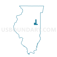
Outline

Summary
| Unique Area Identifier | 570887 |
| Name | PELLA Voting District |
| County | Ford County |
| State | Illinois |
| Area (square miles) | 36.15 |
| Land Area (square miles) | 36.15 |
| Water Area (square miles) | 0.00 |
| % of Land Area | 100.00 |
| % of Water Area | 0.00 |
| Latitude of the Internal Point | 40.80651880 |
| Longtitude of the Internal Point | -88.18369680 |
Maps


Graphs
Select a template below for downloading or customizing gragh for PELLA Voting District, Ford County, Illinois


Neighbors
Neighoring Voting District (by Name) Neighboring Voting District on the Map
- ASHKUM 1 Voting District, Iroquois County, IL
- BRENTON Voting District, Ford County, IL
- CHARLOTTE Voting District, Livingston County, IL
- CHATSWORTH 2 Voting District, Livingston County, IL
- DANFORTH Voting District, Iroquois County, IL
- DOUGLAS 1 Voting District, Iroquois County, IL
- MONA Voting District, Ford County, IL
- SULLIVAN Voting District, Livingston County, IL
Top 10 Neighboring County Subdivision (by Population) Neighboring County Subdivision on the Map
- Douglas township, Iroquois County, IL (2,104)
- Ashkum township, Iroquois County, IL (1,542)
- Chatsworth township, Livingston County, IL (1,366)
- Brenton township, Ford County, IL (973)
- Danforth township, Iroquois County, IL (928)
- Sullivan township, Livingston County, IL (724)
- Mona township, Ford County, IL (334)
- Pella township, Ford County, IL (176)
- Charlotte township, Livingston County, IL (136)
Top 10 Neighboring Place (by Population) Neighboring Place on the Map
Top 10 Neighboring Unified School District (by Population) Neighboring Unified School District on the Map
- Prairie Central Community Unit School District 8, IL (11,294)
- Iroquois West Community Unit School District 10, IL (5,123)
- Tri-Point Community Unit School District 6-J, IL (2,940)
Top 10 Neighboring State Legislative District Lower Chamber (by Population) Neighboring State Legislative District Lower Chamber on the Map
Top 10 Neighboring State Legislative District Upper Chamber (by Population) Neighboring State Legislative District Upper Chamber on the Map
Top 10 Neighboring 111th Congressional District (by Population) Neighboring 111th Congressional District on the Map
Top 10 Neighboring Census Tract (by Population) Neighboring Census Tract on the Map
- Census Tract 9602, Livingston County, IL (4,690)
- Census Tract 9506, Iroquois County, IL (3,578)
- Census Tract 9503, Iroquois County, IL (3,443)
- Census Tract 9609, Livingston County, IL (2,499)
- Census Tract 9616, Ford County, IL (1,992)
Top 10 Neighboring 5-Digit ZIP Code Tabulation Area (by Population) Neighboring 5-Digit ZIP Code Tabulation Area on the Map
- 60938, IL (2,131)
- 60955, IL (1,901)
- 60921, IL (1,519)
- 60911, IL (1,372)
- 60959, IL (1,082)
- 60930, IL (918)
- 60929, IL (730)
- 60946, IL (426)